


GRIGGS EAST PCT 8, St. Francis County, Arkansas
About
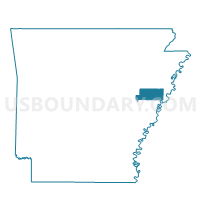
Outline

Summary
| Unique Area Identifier | 527999 |
| Name | GRIGGS EAST PCT 8 |
| County | St. Francis County |
| State | Arkansas |
| Area (square miles) | 4.55 |
| Land Area (square miles) | 4.40 |
| Water Area (square miles) | 0.15 |
| % of Land Area | 96.62 |
| % of Water Area | 3.38 |
| Latitude of the Internal Point | 34.99840890 |
| Longtitude of the Internal Point | -90.61562130 |
Maps


Graphs
Select a template below for downloading or customizing gragh for GRIGGS EAST PCT 8, St. Francis County, Arkansas


Neighbors
Neighoring Voting District (by Name) Neighboring Voting District on the Map
- BLACKFISH PCT 7, St. Francis County, AR
- GRIGGS WEST PCT 9, St. Francis County, AR
- MADISON COUNTRY PCT 15, St. Francis County, AR
- RAWLINSON PCT 5, St. Francis County, AR
- ROUND POUND PCT 13, St. Francis County, AR
Top 10 Neighboring County Subdivision (by Population) Neighboring County Subdivision on the Map
- Franks township, St. Francis County, AR (922)
- Griggs township, St. Francis County, AR (746)
- Black Fish township, St. Francis County, AR (111)